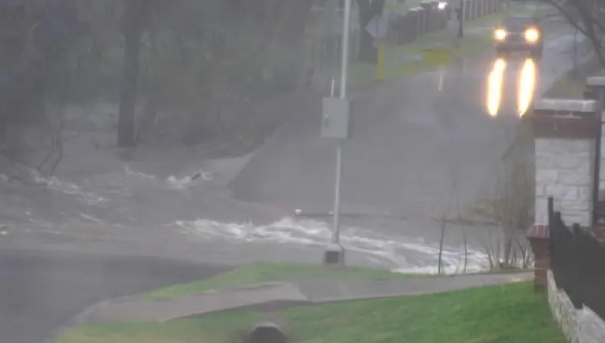
Flash flood warnings remained in effect early Thursday across parts of North Texas after severe thunderstorms dumped several inches of rain, prompting water rescues and stranded vehicles overnight
Flash flood warnings have been issued by the National Weather Service for several counties following stalled storms along a frontal boundary in the Dallas–Fort Worth metro area on Wednesday evening.
A flash flood warning for Van Zandt County is in effect until 2 a.m. Thursday, as officials caution residents about the potential for life-threatening flash flooding. Residents in the affected regions include those in Canton, Wills Point, Edgewood, Fruitvale, and surrounding areas near Lake Tawakoni.
A flash flood warning has been issued for Dallas County, set to remain in effect until 1:45 a.m. This warning also applies to parts of Kaufman and Rockwall Counties.
Forecasters have indicated that the most significant flooding risk is focused in southwestern Dallas County, where late Wednesday night saw rainfall totals ranging from 3 to 5 inches. Forecasters indicated that an extra 2 to 3 inches of precipitation could occur before the storms exited the area.
Emergency crews have confirmed that floodwaters have trapped numerous vehicles, prompting several water rescues as the rainfall intensifies throughout the metroplex.
In Garland, severe storms caused significant structural damage, including the collapse of a warehouse roof due to heavy rainfall shortly before 5 p.m. on Wednesday. According to the Garland Fire Department, the building was located in the 2900 block of West Kingsley Road, near Shiloh Road. Authorities confirmed that there were no reported injuries.
On Wednesday evening, a severe thunderstorm watch was issued for over a dozen counties in North Texas, including Collin, Denton, Tarrant, and Grayson.
Weather experts predict a temporary lull in storm conditions on Thursday, as daytime temperatures are anticipated to rise into the 80s throughout much of North Texas.
Severe storms are expected to return on Friday afternoon and evening, with the possibility of large hail, damaging winds, and isolated tornadoes.
As Saturday approaches, attention may turn to a rising flood risk, with forecasts indicating that further rainfall could impact areas already experiencing saturated ground conditions throughout the region.
Warm temperatures are expected to persist through the week, with morning lows in the 60s and afternoon highs in the 70s and 80s. A cold front is expected to move through on Saturday, potentially lowering nighttime temperatures into the 50s. By Sunday, daytime highs are forecasted to reach the 60s to low 70s.
Authorities have advised residents to exercise caution while traveling overnight and to refrain from driving through flooded roadways, particularly in low-lying areas where water levels can rise rapidly.


From breaking news to thought-provoking opinion pieces, our newsletter keeps you informed and engaged with what matters most. Subscribe today and join our community of readers staying ahead of the curve.
From breaking news to thought-provoking opinion pieces, our newsletter keeps you informed & engaged.


.png)
.png)

.png)


.jpg)