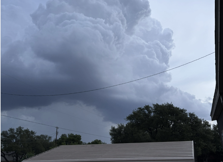
A strong line of thunderstorms fueled by a cold front is moving across North and Central Texas Sunday, bringing the potential for large hail, damaging winds, and isolated flash flooding, forecasters said.
The National Weather Service issued a severe thunderstorm watch through 9 p.m. for dozens of counties, including Erath County and Eastland County, where warnings were already in effect earlier in the day.
Meteorologists warned that storms could produce hail up to 2 inches in diameter—roughly the size of hen eggs or golf balls—along with wind gusts reaching 70 to 75 mph. Such winds can bring down trees, damage roofs, and cause power outages.
A severe thunderstorm warning for Erath County remained in place into the late afternoon, with storms moving east to southeast and producing hail and winds up to 60 mph. Similar warnings were issued for Eastland County earlier.
Forecasters said the storm system will evolve in phases. Initial “discrete” storms developing on Sunday are expected to pose the greatest risk for huge hail. As the system progresses into the evening, those storms are likely to merge into a larger cluster or broken line, shifting the primary threat to widespread damaging winds.
In addition to wind and hail, heavy rainfall is expected. While most areas will see typical storm totals, forecasters estimate a 10% to 15% chance that some locations could receive up to 4 inches of rain, increasing the risk of localized flash flooding.
The timing and intensity of the storms depend heavily on the movement of the cold front as it pushes south across the region. Weather activity earlier in the day near the Red River may influence how quickly the front advances and where the strongest storms develop.
The watch area includes a wide stretch of Central Texas counties, from Bell County to Taylor County, as officials urge residents to remain alert.
Emergency officials recommend closely monitoring forecasts and having multiple ways to receive weather warnings, especially since the most severe conditions are expected during the late afternoon and evening.


From breaking news to thought-provoking opinion pieces, our newsletter keeps you informed and engaged with what matters most. Subscribe today and join our community of readers staying ahead of the curve.
From breaking news to thought-provoking opinion pieces, our newsletter keeps you informed & engaged.